 Guestbook
 Mastadon
 Feeds
Feeds Statistics
The Patrick O'Brian Mapping Project was sponsored in 2011 by Art Marine. If you are a fan of Patrick O'Brian or the Napoleonic age of sail, you should go and check out some of their amazing prints, Remarques and oil paintings.
I would like to thank the following people who provided invaluable help in building the massive quantity of data that drives the Patrick O'Brian Mapping Project:
Donations
- Josh Gilliland
- Juan Herena
- Andrew Seal
- Emmett Harty
- David Burnett
- Keith Barry
- Rosemary Thomas
- Scott Edmonds
- Glenn Male
- Carl Oberg
- Pat Hosier
- Kenneth Kopp
- David Hammond
- Brian Durham
- Kieron Quinn
- John Muenchrath
- Robert Ogden
- John Leydecker
- Scott Campion
- James and Anne Horn
If you would like to support the project:
Contributions
- Tom Marlow - Special thanks to the first contributor of mapping data to this project and has (so far) provided 66 carefully mapped points from the Surgeon's Mate.
- Don Seltzer - Frequently answering my obscure questions and providing answers based on solid fact or very educated guesses.
- Helen Webb - Collecting and providing access to a compiled list of Lissun coordinates.
- Colin White - Finding Ashgrove.
- Jane Skinner - The use of the Aubrey Coat of Arms.
- Kerry Web- The use of Collioure images and his excellent analysis of the Nutmeg of Consolation.
- Dave Smith - Gibralter and Cape Horn images.
- Jaap Fabriek - Finding Stephen's Castle, Requesens, Toulon and Coullioure images. Trying to find Calvette. Study of Pulo Batack, Telanjang and Pulo Kampong. Comments on Pulo Batang and the fate of Pollux the New Founderland
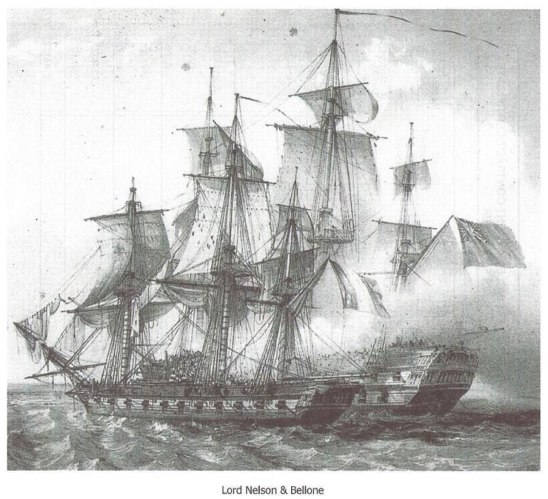
- Paul Mackness - Auguste Mayer's somewhat distorted painting of the "Lord Nelson" and "Bellone" action. Pointing out the location of the RN anchorage closest to Chatham as a resident of those parts.
- Mal Marchant - Pointing out the front and back of the Dogger Banks.
- TheCaptain from Megalithic for use of this Dodman image
- National Oceanic and Atmospheric Administration/Department of Commerce for this image.
- Voyage of the Scotia site and the Royal Scottish Geographical Society for the use of this 1902 image of the St Paul's Rocks
- Bruce Trinque - Informed comment on the Surprise's course around Madagascar during Jack's first command of her. Observations on Testudo Aubreii. His excelent article on the Mauritius Campaign. Discussion on the location of our Desolation Island
- Adam Quinan - Informed comment on the Surprise's course around Madagascar during Jack's first command of her. Observations on Testudo Aubreii. Discussion on the location of our Desolation Island.
- Larry Finch - More observations on Testudo Aubreii.
- Niklas Holmstrom at Sea Watching for use of this Dry Salvages image
- Ian Junor for use of this Noah's Ark Image
- South African National Parks (SANParks) for use of this Cape Agulhas image
- Missouri Botanical Garden for the use of this Screw-Pine image
- Yann Von Arnim for his essay on the wreck of the HMS Sirius and permission to use this image of the HMS Sirius.
- The National Library of Australia for access to their incredible online map resource and for permission to use various map images in the Mauritius Region
- THe USS Constitution Museum for their assistance in finding the course of the USS Constitution in the period described in Fortune of War.
- Fisheries and Oceans Canada, 2005 for the Nova Scotia Banks image.
- Jon Romig for very useful comments on the location of Grimsholm.
- Don Myatt for help with the various Kingston's.
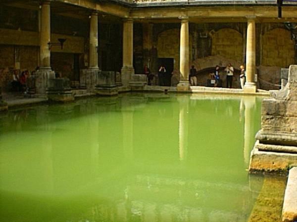
- Alan Pond for his wonderfully greenish Bath Bath image.
- Charles for his useful analysis of the encounter between the Torgud and the Surprise.
- The Museum Victoria for their 1870 photograph of the Strada Reale
- Cilialacorte.com for their explanation of the renaming of Strada Reale in Malta
- HMB Endeavour for their help with the dimensions of their wonderful vessel.
- David Gerrard for the use of his Nix Mangiare photo.
- Nick Barnes for locating Cape Vares on the Spanish coast for the Commodore map
- Jonathan Stanley for his help debugging the issue with Google map tiles failing to load
- Thanks to Ian Bradley and Michael Shank for their Albanian insights and, of course, for creating that podcast of all the world The Lubbers Hole